In honor of National Trails Day, we are celebrating great views in the Raystown Lake Region that you can’t access from a car – you have to get to them by hiking or biking on a trail.
Mid-State Trail (MST)
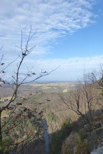
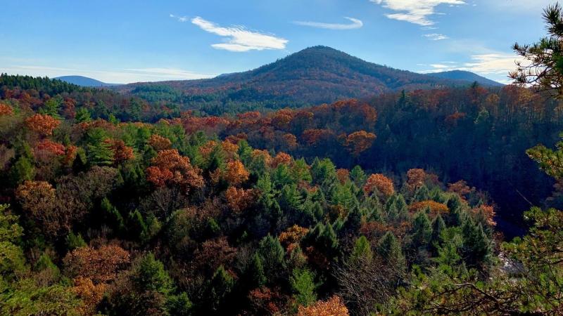
The Mid-State Trail passes through the Raystown Lake Region along the Tussey Mountain Ridge and Lower Trail as it connects the Mason Dixon Line to upstate New York. There are many great vistas from the MST in the region. Our friends at Purple Lizard Maps recommend the Indian Lookout on the Yellow Arrow Trail spur near Spruce Creek: “Yellow Arrow Trail is not an easy trail. Although switchbacks are provided, it is still a challenging trail to climb in the late afternoon. The entire length of this trail is less than one mile, making it a great option to get up and down to the vista before dark on those weekday evening adventures.” Image below courtesy purplelizard.com.
GPS Location: 40.62489827936624, -78.10462147717404
Standing Stone Trail (SST)
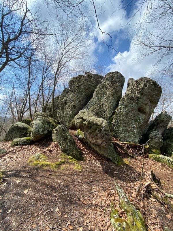
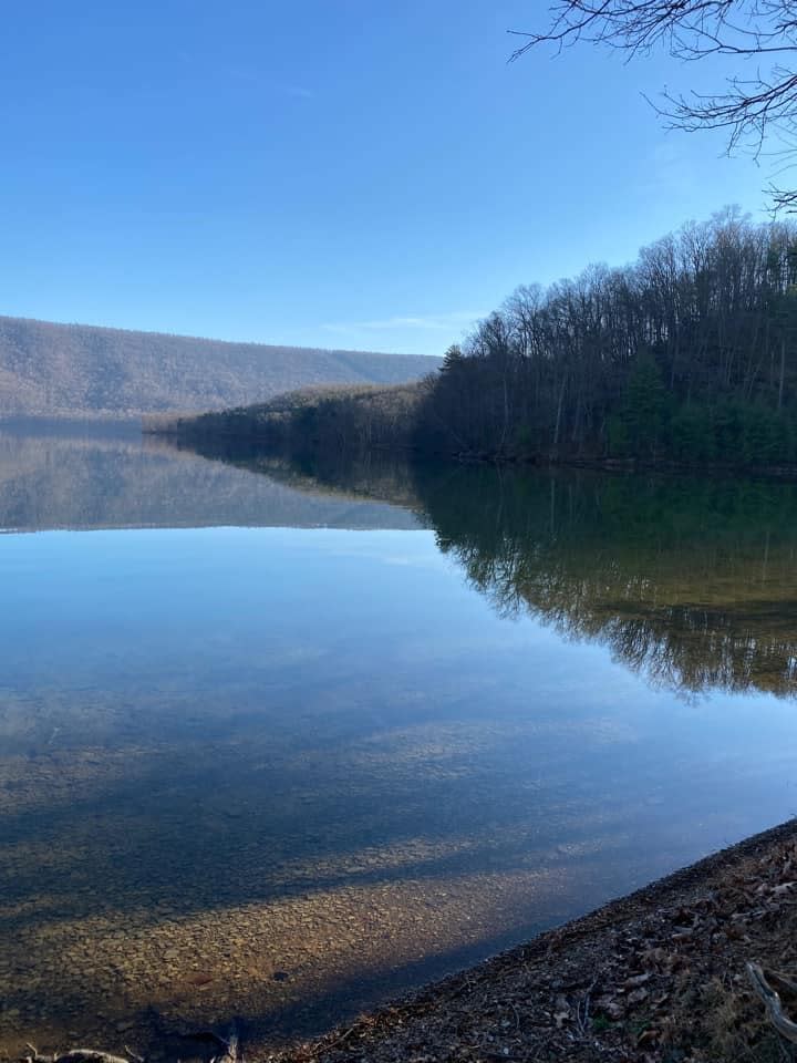
The Standing Stone Trail connects Cowan’s Gap State Park to Greenwood Furnace State Park and the Mid State Trail along its 80-mile corridor. The SST offers dozens of great views including sixteen favorites which can earn hikers the “Sweet 16 Challenge” patch and certificate. https://www.standingstonetrail.org/copy-of-standing-stone-suggested-ca Two of the favorites on the Sweet 16 Challenge are the Throne Room and the Three Sisters.
According to InterestingPennsylvania.com, "This landscape is seriously rocky and exciting to hike. The Standing Stone Trail runs 80 miles and connects the Mid-State Trail to the Tuscarora Trail. The Throne Room gives a tremendous view of the rugged Alleghenies from an impressive boulder field at the top of a ridge." https://www.interestingpennsylvania.com/2018/04/standing-stone-trail-hiking-to-throne.html
Throne Room photo below courtesy of interestingpennsylvania.com.
GPS Location: 40.315820, -77.960489

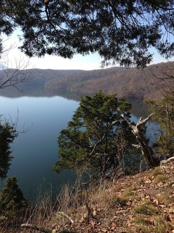
Rosella Radek administers a Facebook Group for Raystown Hiking and Backpacking and shared the image below with us of the Three Sisters on the Standing Stone Trail, which she loves.
GPS Location: 40.56156336990705, -77.85536109754541
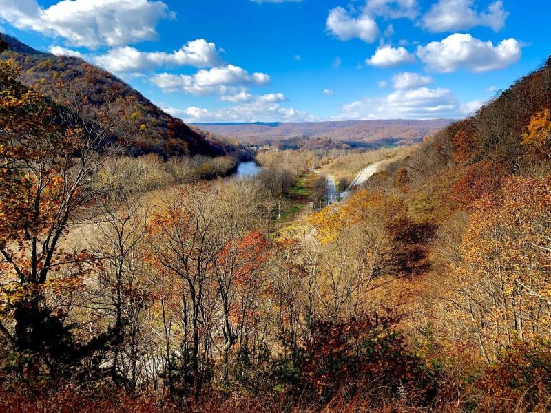
Thousand Steps
The historic Thousand Steps trail is a popular segment of the Standing Stone Trail in Jack’s Narrows. Don’t allow yourself to stop when you reach the top of the steps, though! Your true reward is continuing on a little further to Ledge Quarry Overlook. The overlook high above Mapleton and the Juniata River is definitely worth the effort required to climb Jacks Mountain on the Thousand Steps. Photo by Zac Waite.
GPS Location: 40.39649674299117, -77.91409397978681
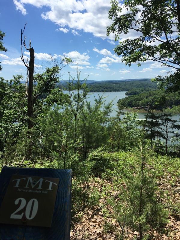
Terrace Mountain Trail (TMT)
The 25-mile Terrace Mountain Trail runs the length of Raystown Lake on its eastern side along its namesake Terrace Mountain. The TMT passes through Lake Raystown Resort, Tatman Run Recreation Area and Trough Creek State Park. There are several scenic spots along the trail. One favorite is the point where Great Trough Creek empties into Raystown Lake as pictured in this photo submitted by Dusko Popov.
GPS Location: 40.33335367531284, -78.12372371950232

A great scenic overlook along the TMT is located at mile marker 20 which provides a view across Raystown Lake of the Susquehannock Campground. Photo below submitted by Lynn Klingel.
GPS Location: 40.384280755068126, -78.03541226216578
Ledges Trail Trough Creek State Park
Local hiker Zac Waite loves the Ledges Trail in Trough Creek State Park, and has photographed it in all seasons.
GPS Location: 40.321394576469125, -78.13098119441439
Old Loggers Trail (OLT)
The Old Loggers Trail in the Seven Points and Susquehannock areas of Raystown Lake is a 4-mile loop trail that climbs down to the shore of Raystown Lake providing the view shown below in this photo by Rosella Radek.
GPS location: 40.391831973574355, -78.0697943110783
Getting off the OLT loop takes you on the trail’s Sheep Rock spur which is rewarded by the view below submitted by Bruce Tomaselli.
GPS Location: 40.39477175858506, -78.05635657994468
Allegrippis Trail System (ATS)
The Allegrippis Trails at Raystown Lake is a 36-mile stacked loop trail system built for mountain bicycling, but open to hiking as well. The trails within the system are named, and you can pick up a map at the Raystown Lake Visitor Center. The intersection of Ridge, Berry Patch and Ray’s Revenge trails is the counterpoint to the ever-popular Hawn’s Overlook showing the same area of Raystown Lake from the opposite side. The view is better in the late fall and winter when the leaves are off the trees, but it’s worth the ride or hike any time of year. Photo below by Abram Landes.
GPS Location: 40.42074922662819, -78.03149766243125